
1959
Freeway construction passes through established neighborhoods in the Twin Cites. The Rondo neighborhood, long a center of black community life in St. Paul, is razed to make way for Interstate 94. Four hundred houses are condemned and torn down.*
“If New York has its Lenox avenue, Chicago its State street, Philadelphia its Wylie avenue, Kansas City its Eighteenth Street, and Memphis its Beale street, just as surely has St. Paul a riot of warmth, and color, and feeling, and sound in Rondo street.”
–Earl Wilkins, The St. Paul Echo, September 18, 1926**
Connecting the Twin Cities of Minneapolis and Saint Paul had long been in the minds of local civil engineers. The excerpt below from the MNopedia article by Ehsan Alam sums up their thoughts rather precisely.
“In the 1930s, commuters and city planners began to call for a highway linking the business districts of downtown St. Paul and Minneapolis. After World War II, city engineers chose St. Anthony Avenue as the route. This street was located between University Ave and Marshall Avenue, and went all the way to Minneapolis.”***
Yet, that is not the whole story. We find that there is a viable alternative to either Rondo or St. Anthony Avenues that wouldn’t split an existing neighborhood in half. Minnehaha Avenue, now known as Pierce Butler Route, is road that runs adjacent to the rail lines between Minneapolis and Saint Paul. Often, the land adjacent to rail lines is already publicly owned, and would suggest that this route may encroach less on neighborhoods and privately owned property. ****
Given these circumstances, one wonders “Why did these cities and Federal Department of Transportation leaders choose to place I-94 through many neighborhoods (including Rondo) instead of adjacent to them?” In any type of city planning or civil engineering events, there are myriads of motives and opinions that compete to be heard. Below, we explore a few hypotheses.
George Herbert Herrold, an engineer and city planner far and away has the most documentation of the City Planning Board of St. Paul, Minnesota. His manuscript covers a 33 year time frame from the start of the Board in 1920 until 1953; just the years that would tell us of their motives, studies, and actions. This research suggests that the city had an interest in eliminating slums. To elaborate, their working definition of a slum constituted a neighborhood with a high percentage of rental properties whose owners did not live in the neighborhood. *
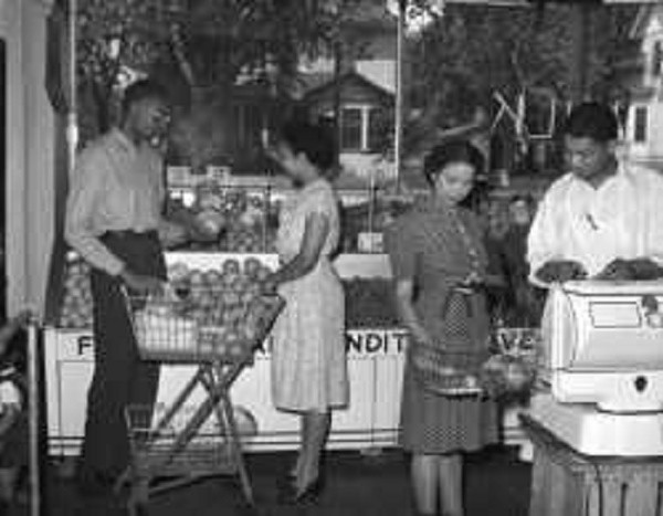
However, what the Board defined as “slums” also was home to the largest African-American neighborhood in St. Paul. Granted, there were some run-down rentals, but there were also a large contingency of fine homes belonging to Rondo’s middle-class residents. Rondo had a population of roughly 30,000 of which about one-third were black, and the remainder composed by Italians, Jews, Native Americans, and a sprinkling of other ethnicities. It is precisely because of Rondo’s diverse assemblage that suspicions of “red-lining” or racist motives arise in criticism of St. Paul’s role in routing I-94 through this neighborhood.******
In contrast, we find evidence that does not support this conclusion. Department of Transportation employees did extensive studies on both alternatives, as they did elsewhere through the Interstate Highway System. Commonly, this looks like engineers doing on-site observations and gathering data: counting cars on every East-West thoroughfare, establishing “desire lines” (i.e. which roads are most preferred), collecting data on rush hour usage, travel times from origin to destination, etc. Of these DOT engineers professor C. Wells of Macalester College states, “the process that they went through would seem to suggest that race had nothing to do with it…”. **** The data collected suggests that the direct route along St. Anthony Avenue was the preferred route, and support for the “northern route” along Pierce Butler and the railway diminished.
As the neighborhood of Rondo saw the writing on the wall, they peacefully protested and gained concessions. According to the research of Mark Simonsen, their focus became the four points listed below.
1. Stay in homes as long as possible.
2. Receive Fair Market Value for homes.
3. Depress the freeway below street level.
4. Requested that they be able to buy new homes anywhere they could afford them. (Open Housing Law)****
Residents won the first three of these requests, but failed to enact the Open Housing Law. In fact, even the city of Saint Paul declined to honor the Open Housing Law within its boundaries. It’s City Attorney denied O.H.L. on the basis that it conflicted with Minnesota’s constitution; sellers could legally choose to whom they sold their property. ****
Shall we pray? Eternal Father, we are reminded of your words of promise today as we sit and watch this snapshot of history that physically divided the Rondo neighborhood with an Interstate.
“And everyone who has left houses or brothers or sisters or father or mother or wife or children or fields for the sake of My name will receive a hundredfold and will inherit eternal life. But many who are first will be last, and the last will be first.” Matthew 19:29-30 BSB *
We love that we can always come to You for a hearing, and that Your Hearing and Presence bring justice! Be forever praised!
As a starting point, we acknowledge that You provided two paths for Interstate I-94. We acknowledge that the outcome of following the less disruptive “northern route” may never be known. Yet, there was a solid opportunity to choose a route that had less impact on human lives and relationships. Did we miss You in this? Maybe so. In any case, we acknowledge that we chose the road that wrecked neighborhoods. Will You forgive the seeds of division sown in this moment by the proponents and opponents of running the highway by the railway? Where we judged our neighbor, we have offended You; will You heal the past, free the present, and bless the future in this decision of 1959?
Next, we see the depth of consideration and the data collected to resolve this issue. We remember that the DOT and civil engineers went out into the neighborhoods between Minneapolis and Saint Paul, and actually observed where our people drove, how many, and how long it took them to arrive at their destination. Like Your message to the prophet Isaiah, You continually invite us to “come now and reason together”. You are not threatened by our observations, science, data, or investigations!
We thank You that the numbers don’t lie, or in this case, the numbers don’t lie about where we drive; we voted with our wheels. Yet, we fully acknowledge that though “numbers don’t lie”, we are often skewed by our own biases as we interpret them! Will You lift the suspicion of these studies up, out, and onto the Cross? Will You be with us as we reconsider this moment with You?
To continue, we see this data filtered through the distorted looking glass of banking. As a short backstory, we find that the Federal Housing Authority (FHA) had created a system of segregation, real ethnic and racial division, and negated facts that challenged their narrative. It is here, if I can be so bold Lord, that I see some of the ugliest acts of racism and ethnocentrism committed in St. Paul of this era. It is a fact that the FHA created maps based on ethnicity and race. It appears that though the FHA commenced with noble pursuits, in reality it fostered and reinforced the racialization of space.
Lord have mercy! Christ have mercy! We allowed these dreams of placing a home within reach of all to take a wrecking ball to those deemed not worthy by bureaucrats! We give You the damage caused by our State and Federal government’s judgments contained in the word “slums”. We acknowledge to You all the pain and falsehoods spoken over the residents of Rondo like, “a black family will not be given a home loan west of Lexington Avenue.” We acknowledge the defilement of this land through judgment and counter-judgment: from the Mississippi River to Marion Street, from University Avenue to Marshall Avenue; this land is Your land! Will You take these lies, curses, unbeliefs, and misbeliefs up, out, and onto the Cross?
Conversely, will You speak truth to cursed ears and broken hearts? Will You impart life where it has been crushed and stunted? Will You uproot those who have negated human choice because it interferes with their vision of what “helping” looks like? Will You release Your Holy Spirit, and replace the memory of wrecking balls with “Welcome” mats in this Rondo corridor forever?
“Do not afflict your countrymen, but let every one fear his G-d: because I am the Lord your G-d.” Levitcus 25:17 Douay-Rheims Bible
- P.T.H. cites timeline formerly at this URL: mnhs.org/about/dipity_timeline.htm
** https://libguides.mnhs.org/rondo
*** Please enjoy this solid article and research about Rondo!
Alam, Ehsan. “Rondo Neighborhood, St. Paul”. June 14, 2017. Internet. Minnesota Historical Society. https://www.mnopedia.org/place/rondo-neighborhood-st-paul
**** Simonsen, Mark. “Rondo: Building Highways, Building Conflict”. July 14, 2016. Internet. YouTube. Cit. Professor Chris Wells (Macalester) 2:55-3:18.
https://www.youtube.com/watch?v=JaI8USAtJyE
*****Herrold, George Herbert. “The story of planning St. Paul from the beginnings to 1953, 1958.” Minnesota Historical Society Library. Internet. https://snaccooperative.org/vocab_administrator/resources/7080099
****** Redlining and Racial Covenants: Jim Crow of the North https://www.youtube.com/watch?v=ymOaiWla3DU
******* https://biblehub.com/matthew/19-29.htm

Public domain is about proprietary gains. The downside is a big negative when municipalities refuse to invest in communities. 🍂🍮🍂🍮🍂
thanks for checking out my blog
No problem! Isn’t it wild to see our own govt willingness to steamroll a whole neighborhood? I still can’t get over it!