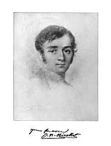
French astronomer Joseph Nicollet’s accurate maps of the upper Mississippi region, made over the course of several visits to Fort Snelling, are published by the U.S. Senate in 1843.*
Thanks for the blessing of accurate maps. Thanks that You give us a real assessment of the situations of our lives. Thank you that good maps help define land uses and indirectly, land disputes!
As I ponder Messr. Nicollet’s involvement in the life of this state, I quickly come to the question, “Why is an astronomer mapping terra firma so far from home?” Although I know so little about astronomy, I can easily imagine that he was trained to map the vastness of space. Perhaps working on such a small scale was a new challenge to him, or no challenge at all. His motives in this work are unknown to me, but would be an interesting campfire story.
However, I am practicing thinking about history as the Eternal Now. This is where Your Spirit leads me. I thank You that You led this man outside his discipline. I thank You that he was taken far beyond his home into the wilderness of North America. I thank You that he shared his gift, even if it was second place to astronomy! Will You bless us as his progeny to embrace the moments in life we are taken out of our expertise, and into the woods?
*www.dipity.com/Minnesota/History/Minnesota-History/