
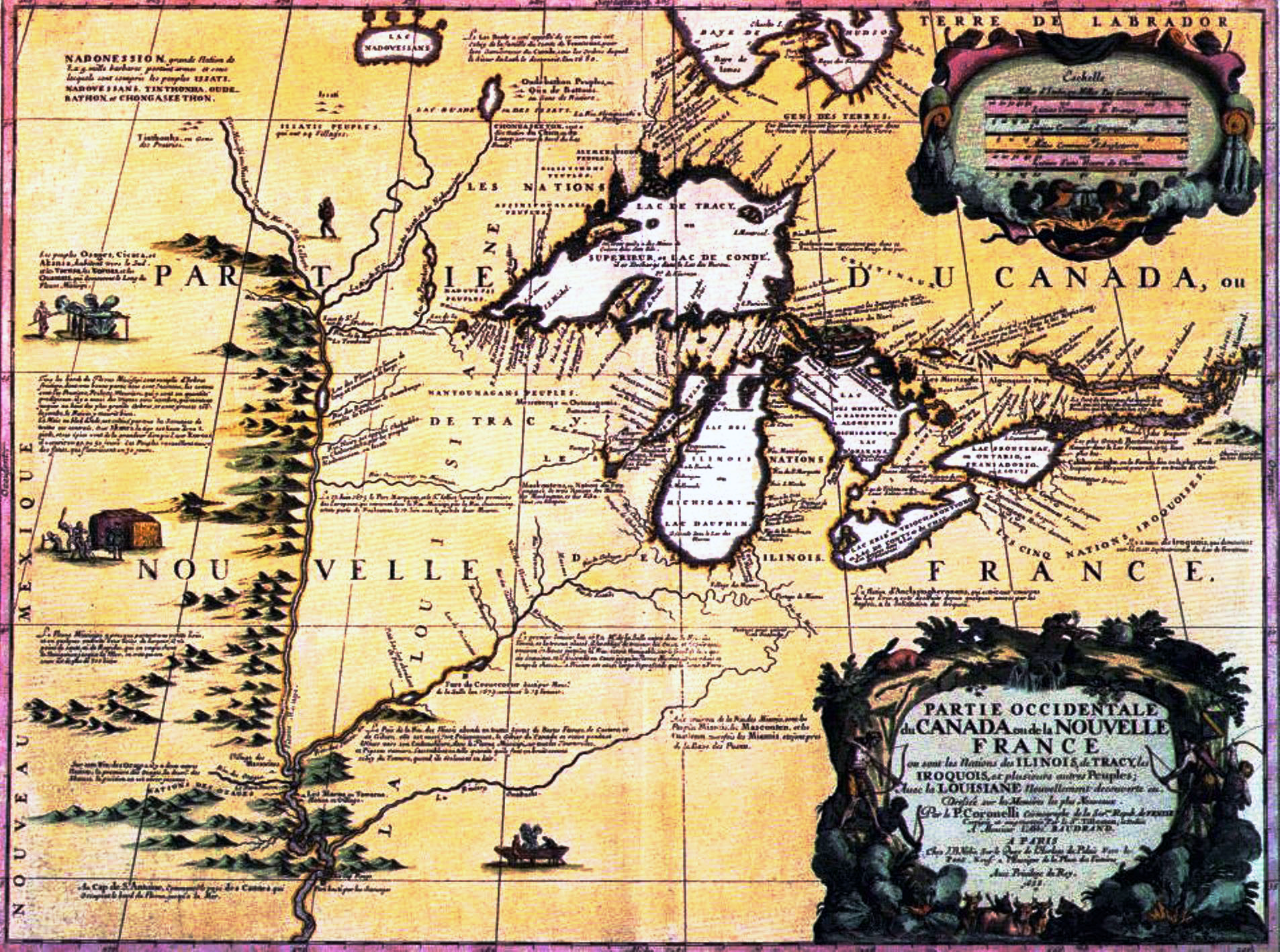
“Partie Occidentale du Canada ou de la Nouvelle France ou sont les Nations des Ilinois, de Tracy, les Iroquois, et Plusieurs autres Peuples; avec la Louisiane Nouvellement Decouverte etc. . . . 1688” Vincenzo Maria Coronelli / Jean-Baptiste Nolin. raremaps.com
“Claude Allouez, a missionary on Madeline Island in the 1660s, explores the western and northern shores of Lake Superior. In 1671, he produces one of the best early maps of the lake, indicating the first European awareness of Minnesota.” *
Lord Jesus, thank You that You are the Way! Thank You for the roadmap of forgiveness that restores broken hearts and relationship! Thank You for the discipline of map-making and bless Allouez, his generations, and dwellings for this gift! Will You bless all future Minnesotans who are committed to showing us the way?
*Note – PrayThroughHistory uses the timeline located for several years at the Minnesota Historical Society Web site, at this URL: mnhs.org/about/dipity_timeline.htm . Currently the timeline seems to be unavailable. I am hopeful that it will be back up in the future, as it was a valuable, user-friendly tool for anyone wishing to explore Minnesota history.
